Everyone loves a historic building. Old buildings connect us to our past, giving us a glimpse into the everyday life of those who came before us and reminding us of the events that shaped our world. But, the love of historic buildings can sometimes go overboard. Historical preservationists often pass laws with good intentions, but these can make owning historic buildings prohibitively costly. As a result, buildings may be left unused and neglected, contrary to the reverence they deserve.
Historic preservation can also impede other important societal goals. Energy retrofits of historic buildings are often hampered by preservation laws, even though they are necessary to help cities reduce their carbon footprint. In many cities, historic buildings also take up critical space needed for housing.
Some historic buildings need to be preserved physically, but for others, the best way to save them is digitally. This was the case with a historic mansion in Merrill, Wisconsin. Built by a lumber baron who was the town’s first mayor, the mansion had been used as a convent, college dormitory, and office. It fell into disrepair and impeded a hospital expansion, leading to its scheduled demolition despite local outcry.
To help preserve the building digitally, a local university team created a detailed 3D scan before demolition. This preserved the memory of the building and helped soften the blow for preservationists who opposed its demolition. “For preservationists, at least, it’s a sense that it’s not completely gone,” said UW-Milwaukee professor Matt Jarosz, who was involved in the project.
Scans are already being taken of many historic buildings. Thankfully, Notre Dame had been meticulously scanned by an art historian before its roof caught fire in 2019. Some historic buildings in fire-prone areas are being preemptively scanned in case they cannot be saved in a disaster. People are even using 3D models to visit buildings destroyed by the fire in Maui last year.
For the relatively small cost of scanning historic buildings, it makes sense to preserve them this way. The scan can be used later to help rebuild or restore the buildings or serve as a historical artifact if the building is destroyed. As we become more accustomed to the idea that visiting a digital representation of a building keeps it alive, we might find it sufficient for some buildings. While some buildings will always be important enough to preserve physically, for others, the need to upgrade or repurpose the land they occupy might outweigh the importance of saving the building itself.
Contents
Digital Twin
Digital Twins Give City Planners and Developers an Urban Growth Sandbox
Digital twin technology, creating virtual replicas of physical objects, is revolutionizing real estate and city planning by allowing for testing and visualization before implementation. This technology, already common in manufacturing, enables improvements in workspace design, sustainability efforts, and 3D tours. Cities worldwide are adopting digital twins to enhance services and planning using real-time data. But challenges like platform integration and cost remain.
High-Quality Scans Are Key to Unlocking the Full Potential of Digital Twins
While many are already familiar with the valuable use cases for digital twins, creating them involves scanning a building, a process with varying costs and complexities. This can range from simple mobile phone methods to complex, expensive professional LiDAR scanning. The cost and complexity are determined by the desired level of accuracy and the scale of the project. While simpler scans suffice for smaller projects, large-scale construction often requires precise LiDAR scanning, typically handled by specialized service providers due to the high cost of the equipment.
Bytes
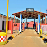
🌏️ Qatar-edge: At the Qatar Economic Forum, a panel of real estate and infrastructure experts discussed how governments can tap into innovators and a diverse pool of capital to create more housing supply.
🌊 Water world: The city of Jacksonville, Florida, is developing a digital twin of the entire city that can be viewed in augmented reality to help visualize, among other things, how sea level rise will affect the city.
Thank you for reading the Propmodo Technology Newsletter! I’d love your feedback, ideas, and tips: [email protected].
If you think someone else might enjoy this newsletter, please pass it forward, or they can sign up here.
Read more: 3D Scanning Is Helping Resolve the Historical Preservation Paradox.